
Nepal Floods and Flood Risk to India: Shared Rivers Explained
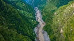
Nepal's recent floods highlight risks to India through shared Himalayan rivers. Peak flows at the border depend largely on rainfall in Nepal, while flood severity in India also hinges on local embankments, drainage and rainfall. The two countries share seven to nine major transboundary rivers that affect states including Bihar and Uttar Pradesh.
How do Nepal's rivers connect to flooding in India?
Nepal contains more than 6,000 rivers and streams. Most flow south into India and join the Ganges basin. The main systems are the Kosi, Gandaki and Karnali, along with smaller rivers such as the Bagmati and Kamala. These waterways cross the border and contribute to flooding in the Indian plains.
Which Indian states face the greatest exposure?
Bihar experiences the highest risk, with roughly three-quarters of northern districts classified as flood-prone. The Kosi river, often called the sorrow of Bihar, along with the Gandak, Bagmati and Kamala, originate in Nepal. Eastern Uttar Pradesh is also affected by the Ghaghara, Rapti and Gandak rivers. Uttarakhand and parts of North Bengal receive flows from additional shared rivers.
What factors turn Nepal rainfall into Indian floods?
Experts describe a three-part process. Intense rain often falls in Nepal's lower mountain zones rather than the high Himalayas. Rivers then lose gradient at the mountain front and deposit sediment. Once water crosses into India, local rainfall, Ganges levels, embankments and drainage determine how severe flooding becomes. The 2008 Kosi event showed that embankment failure, not extreme river flow, caused most damage.
How much warning time does India receive?
Normal monsoon floods can provide between 12 hours and two days of advance notice. Flash floods from smaller catchments may arrive faster. India and Nepal exchange real-time rainfall and river data, yet gaps exist in monitoring steep Chure basins and in joint forecasting models.
Frequently asked questions
Does Nepal release water into India?
Nepal has very few large reservoirs. Flood peaks reaching the border result from upstream rainfall, not controlled releases. The Kosi and Gandak barrages are operated by India.
Is climate change increasing these risks?
Yes. The region is warming faster than the global average. More intense rainfall bursts and degrading permafrost raise the likelihood of debris-laden floods and glacial lake outbursts.
Key takeaways
- Nepal supplies around 40 percent of the Ganges average annual flow.
- Bihar remains India's most flood-exposed state from Nepal-origin rivers.
- Embankment condition and Indian-side drainage affect flood severity as much as upstream rainfall.
- Shared real-time data exists but monitoring gaps persist in fast-response catchments.
- Debris flows and sediment movement are growing hazards on both sides of the border.
